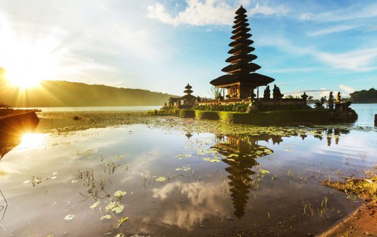
The story of Bali’s famous Manta Point didn’t begin with a map or a planned expedition. It began with a simple tip from a local fisherman in the mid-90s. Back then, only a handful of dive centers operated around Bali, and the dive community was tight-knit. Ocean lovers would gather, trade stories and share sightings of marine life across the islands.
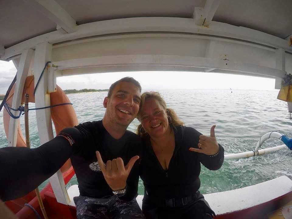
Among those early explorers was PADI Course Director Minni Vangsgaard (CD-502165), owner of Bali Crystal Divers, who would later help shape the diving community in Bali. Inspired by the fisherman’s story about “a place full of mantas,” Minni decided to investigate. That spark of curiosity, and the many dives that followed, helped bring global attention to what is now one of Bali’s most iconic marine sites. The manta cleaning station on the southwest coast of Nusa Penida is now widely known as Manta Point.
What Minni did back then wasn’t just exploration; it was the early stage of what divers today know as dive site mapping. Before anyone could call Manta Point a dive site, someone had to understand its contours, its currents and the manta ray behaviour that made it special.
What Is Dive Site Mapping?
Simply put, mapping a dive site is the process of creating a visual representation of the underwater environment, pinpointing depths, landmarks and other points of interest. A good dive map should work like a roadmap. Give it to someone who’s never been to the site, and they should be able to find the key points of interest.
Divers break dive site mapping into three categories: training-based, operational and exploratory. Every divemaster candidate goes through training-based mapping for a pre-existing dive site as part of the divemaster course. Certified divemasters and instructors joining a new dive center will go through operational mapping as they become familiar with their new dive center’s dive spots. And then we have exploratory mapping. Which, we argue, is the most exciting of all.
While exploratory mapping, you’re looking for formations, wrecks or behavior patterns like the cleaning stations at Manta Point. But you do not have any other maps to reference (like when training) because you’re the first to do it! This process of mapping requires multiple dives to identify the patterns, conditions and the marine life that frequents it. Often, the same site is explored 10-15 times before it can be marked as a true point of interest and used as a dive site.
Manta Point Before It Was “Manta Point”
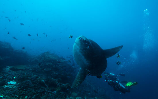
When Minni and the Bali Crystal Divers team first explored the area, their goal wasn’t to “discover” a new site; it was simply to follow a lead. After snorkeling surveys around the cliffs of Nusa Penida, they observed something remarkable: large silhouettes gliding gracefully beneath the surface.
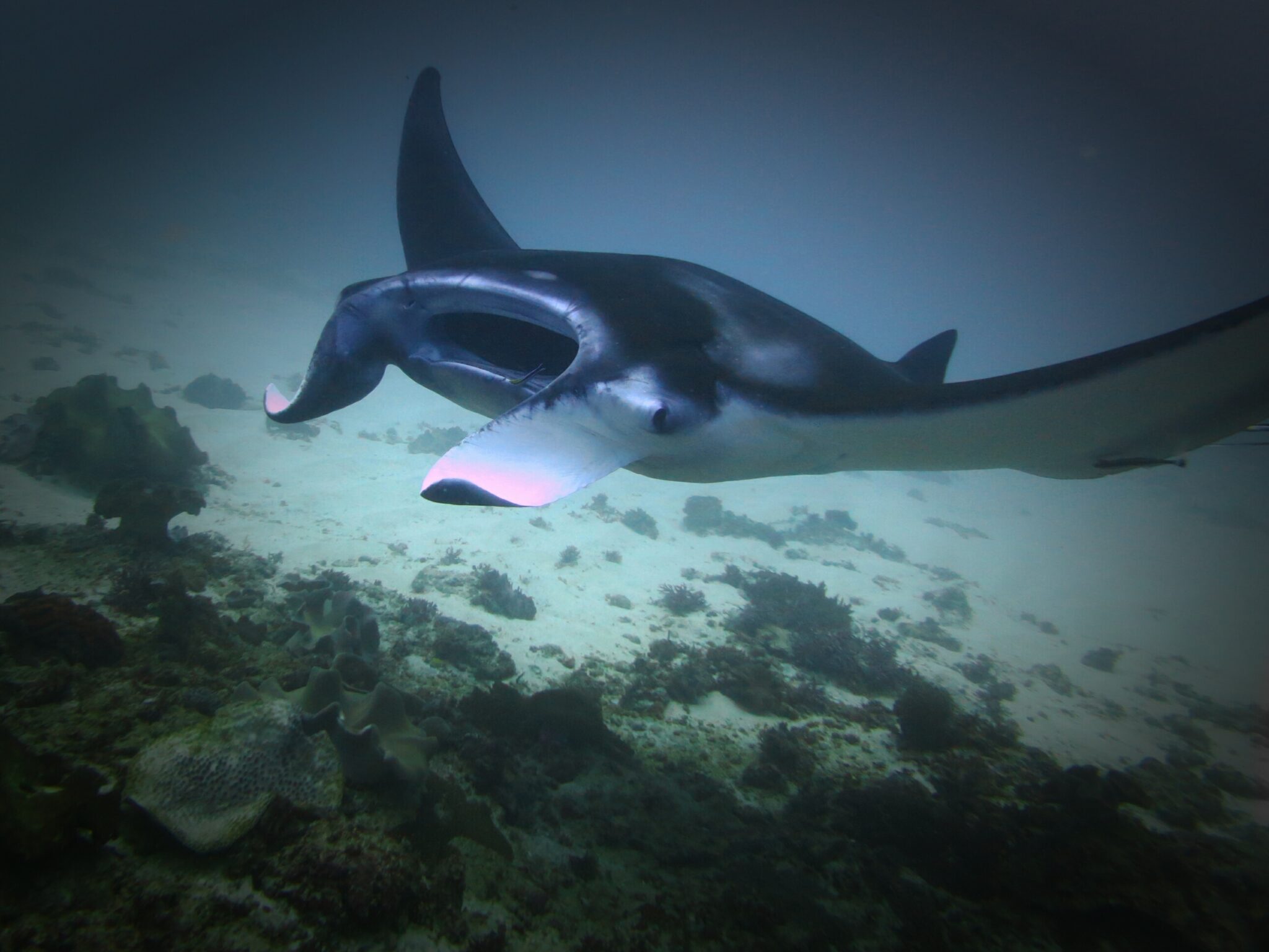
What started as curiosity naturally became a form of exploratory dive site mapping. With each return visit, they noticed patterns. The manta rays would circle a shallow area repeatedly, a behavior later understood as cleaning-station activity. Over time, this consistency allowed divers to identify the site more clearly. Importantly, Manta Point isn’t a single point; it is a larger bay shaped by manta behavior, with numerous cleaning stations, feeding zones and natural formations all influencing how the rays move.
Then vs. Now: What’s Changed in 30 Years of Diving
Much has changed in Bali since the 90s. Boats are faster, gear is more advanced and the dive community has grown. But through it all, one thing has remained remarkably consistent: the mantas are still there. Manta Point continues to deliver the same encounters that first drew divers to it nearly 30 years ago. In addition, new research led by MMF Indonesia’s Janis Argeswara reveals trends in the population of manta rays in Nusa Penida, based on key findings from the 11-year study spanning 2012 to 2023. It’s a reminder of how powerful and also how delicate these marine ecosystems are.
As part of local stewardship efforts, Minni’s team at Bali Crystal Divers, alongside other PADI Dive Centers such as Legend Diving Lembongan, Purple Dive Penida, and Bali Aqua Nusa Penida, have adopted Manta Point through PADI’s Adopt the Blue™ program, contributing to the ongoing protection of this unique ecosystem.
That’s where mapping and conservation come in. By revisiting both well-known and less-travelled sites, divers can document coral health, spot recovery from past damage and better understand the effects of environmental stress and overtourism. These critical marine sites need protecting, and as divers, we share responsibility for their wellbeing.
Final Thoughts
A strict code of interaction should always be observed to avoid stressing these amazing animals and potentially driving them away to a new cleaning station without humans. It’s our responsibility to ensure the dive site and the ocean continue to thrive. Exploration is not about perfection or instant gratification. You might dive 50 new places and find nothing, but one incredible site makes it all worth it. Mapping is a blend of science, instinct and storytelling.
As Minni herself has demonstrated, after more than 14,000 dives, there is always something new to learn beneath the surface. That is the true magic of mapping the unknown.
Curious about Manta Point? Then it’s time to start planning your trip!
This article was written by guest blogger Alex Walker. Since 2017, Alex has been one of the driving forces behind Crystal Divers in Bali, serving not only as the General Manager but also as a Platinum PADI Course Director. With over 21 years of experience as an instructor, Alex has taught thousands of aspiring dive professionals. Through his work, he hopes to continue growing and positively impacting the diving world with every new instructor who passes through his doors.